Season 7: 8th November – 6th December 2018
Objectives:
The seventh and final field season of the SUNDASIA Project undertook to meet five principal objectives, these are listed below:
1) Human remains reconstruction:
- Reconstruction of (and collection of biometrics from) the Thung Binh 1 skeleton begun in January 2018 will continue. Priority will be given to reconstructing the skull. A photogrammetric model of the skull will be created, providing the necessary data-point cloud for 3D printing and facial reconstruction.
- Field reconstruction and biometric analysis of the Hang Moi skeleton will also be undertaken.
- Provision for long-term curation of both skeletons to be arranged.
2) Excavation:
- At Hang Moi, trench 1 will be expanded and site infrastructure upgraded to facilitate access to the burial location. Principal excavations at this site will then focus on recovery of the skeleton.
- At Hang Thung Binh 1, excavations will continue in trench 2 with the aim of reaching the base of the Pleistocene-Holocene shell midden there.
- Upon consultation with the Management Board, remedial work (e.g. site clearing and trench backfilling) will take place at all SUNDASIA sites.
3) Palaeoenvironmental reconstruction:
- Dedicated herbarium specimen collection
- Floristic study
- Recover all pollen traps for analysis
4) Landscape survey:
- Hand-coring a selected locales (including Vung Tham) to sample potential local clay sources that may have been used in Da But pottery making.
- Lithic raw material survey
- Shell survey (including local sub-coastal location outside Tràng An)
- Complete total station sea-notch recording programme (including visit to national sea-level datum at Hon Dau).
5) Conservation and managerial measures:
- Langur Island photogrammetric model to be created + quantitative survey
- Further sample of dead-fall from Hang Ang Noi
- One-day workshop at the end of the season.
Field Team (UK):
Ryan Rabett (QUB)
Christopher Stimpson (QUB)
Thorsten Kahlert (QUB)
Shawn O’Donnell (QUB)
Rachael Holmes (Bournemouth Univ.)
Ciaran Kelly (QUB)
Aaron Redmond (QUB)
Emilie Green (University of Cambridge)
Ioanna Bachtsevanidou Strantzali (QUB)
Evan Hill (QUB)
Ruairidh Macleod (University of Cambridge)
Benjamin Utting (University of Cambridge)
Alex Wilshaw (University of Cambridge)
Ara Espigar (University of the Philippines)
Marcus Verhoeven (RAAP Archaeological Consultancy, The Netherlands)
Field Team (Vietnam):
Bui Van Manh (Ninh Binh Department of Tourism)
Sinh Phan Khanh (Trang An Management Board)
Nguyen Thi Mai Huong (Institute of Archaeology)
Vu Duy Linh (Archaeological Officer, Trang An Management Board)
Vu Thi Lien (Trang An Management Board)
Nguyen Thu Loan (Trang An Management Board)
Truong Thi Quynh Trang (Trang An Management Board)
Vu Thuy Linh (Trang An Management Board)
Pham Tuan Luan (Ninh Binh Provincial Museum)
Nguyen Thu Huong (University of Social Sciences and Humanities, Hanoi)
Tong Son Van (University of Social Sciences and Humanities, Hanoi)
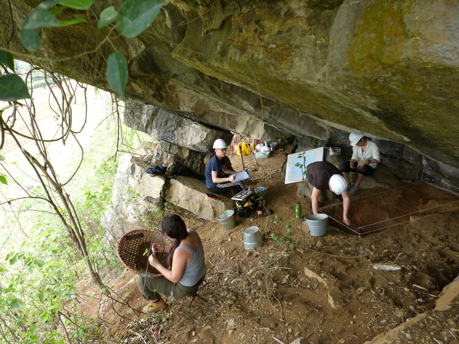
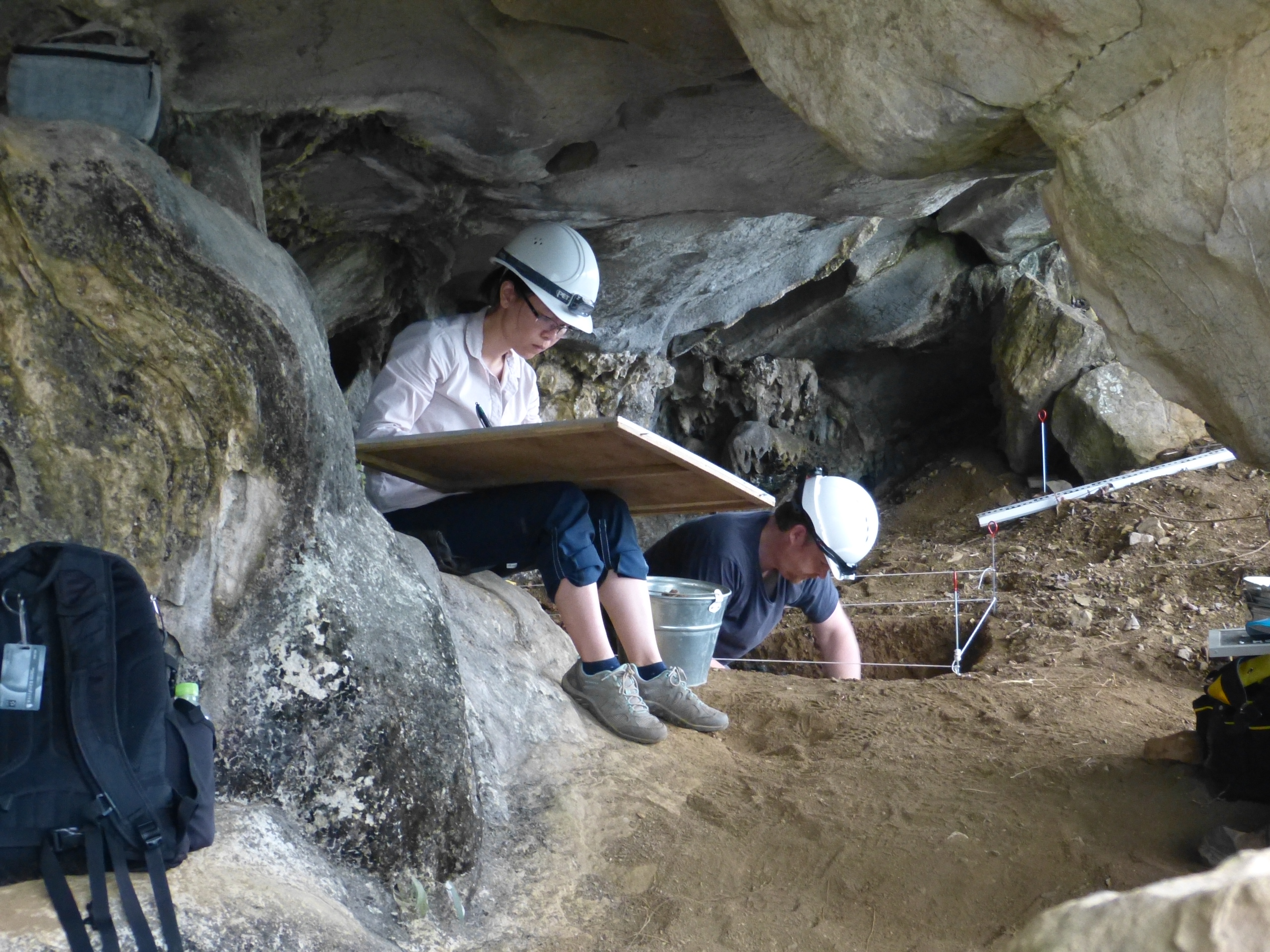
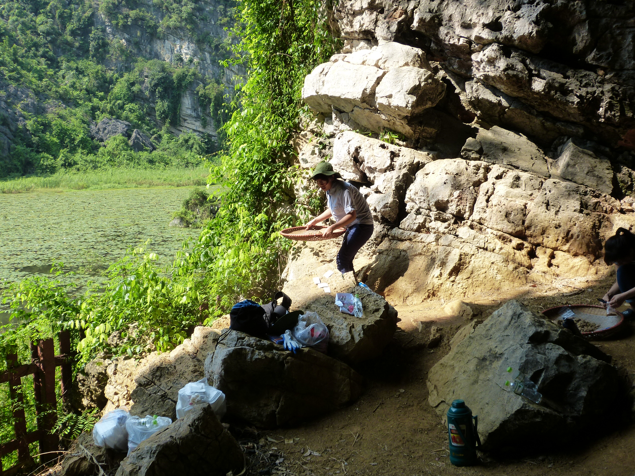
Selected photographs from the field season:
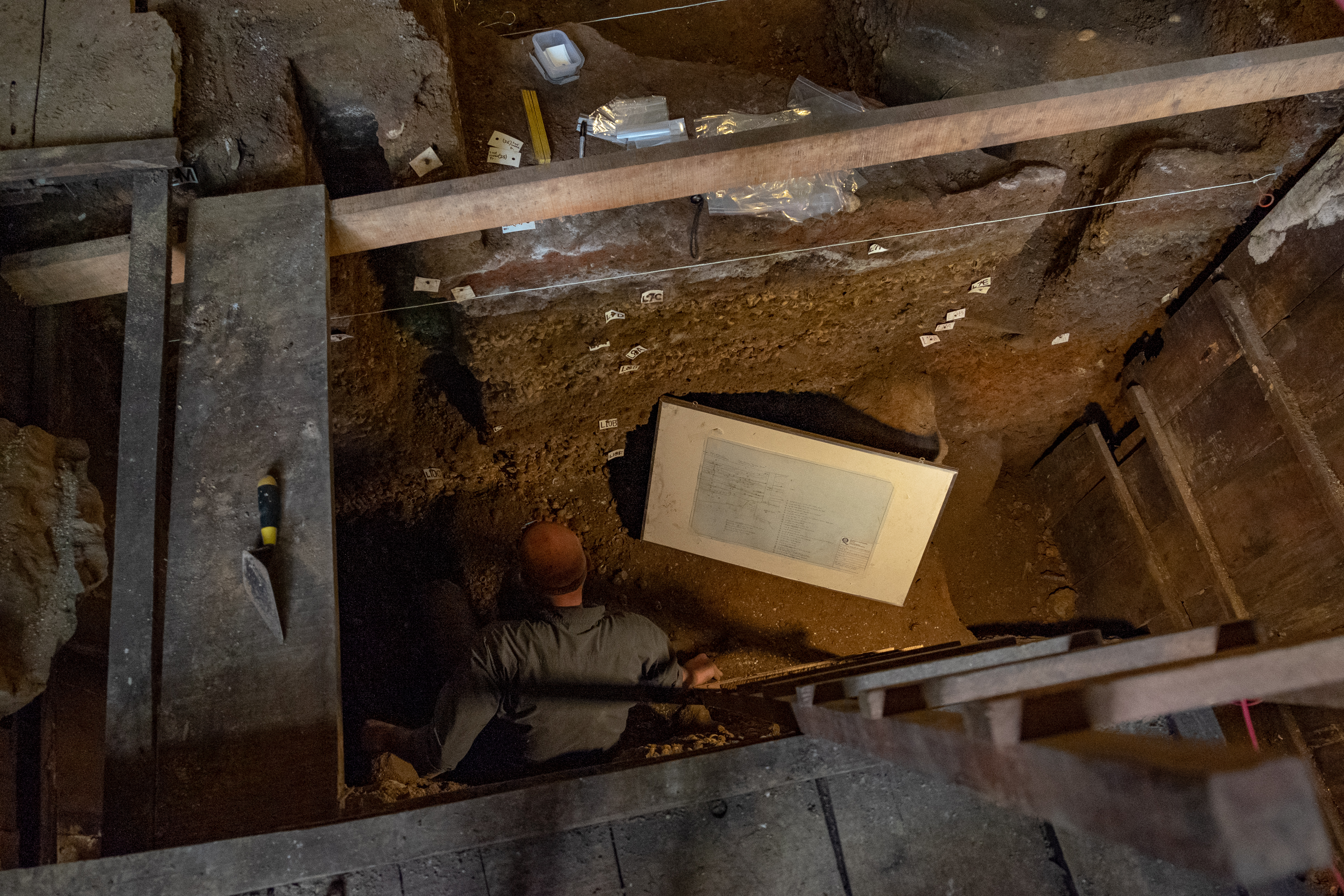
Thorsten Kahlert and Thuy Vo T.P. conducting a photogrammetric survey of the Thung Binh 1 excavation (Trench 2) (photo: R. Rabett)

Marcus Verhoeven section drawing in Hang Moi (photo: S. O’Donnell)
Nguyen Thi Mai Huong, Shawn O’Donnell, Emilie Green and Nguyen Thu Huong lifting core samples for pottery clay sourcing analysis (photo: R. Holmes)
Season 6: 4th – 25th April 2018
Objectives:
1) Excavation:
Trench 2 excavations at Hang Thung Binh 1, especially within the Pleistocene midden that we have been tracking over the past couple of seasons. Indications from our own dates and those from the trench excavated by the Institute of Archaeology is that occupation commenced soon after the end of the Last Glacial Maximum, making this an increasingly key site given its location on the edge of the massif.
2) Palaeoenvironmental reconstruction:
This will involve collecting samples of extant flora for a dedicated herbarium specimen reference collection. It will also include mechanised coring in the northeast corner of the Ui Valley to achieve a profile of valley sediments on the western side of the massif, to pair (in the first instance) with that already obtained on the eastern side near the Hoa Lu Ancient Capital. Finally, we shall also undertake hand-augering at selected locales within the project’s principal landscape transect (within the property core-zone) between these two major bore-holes.
3) Landscape survey:
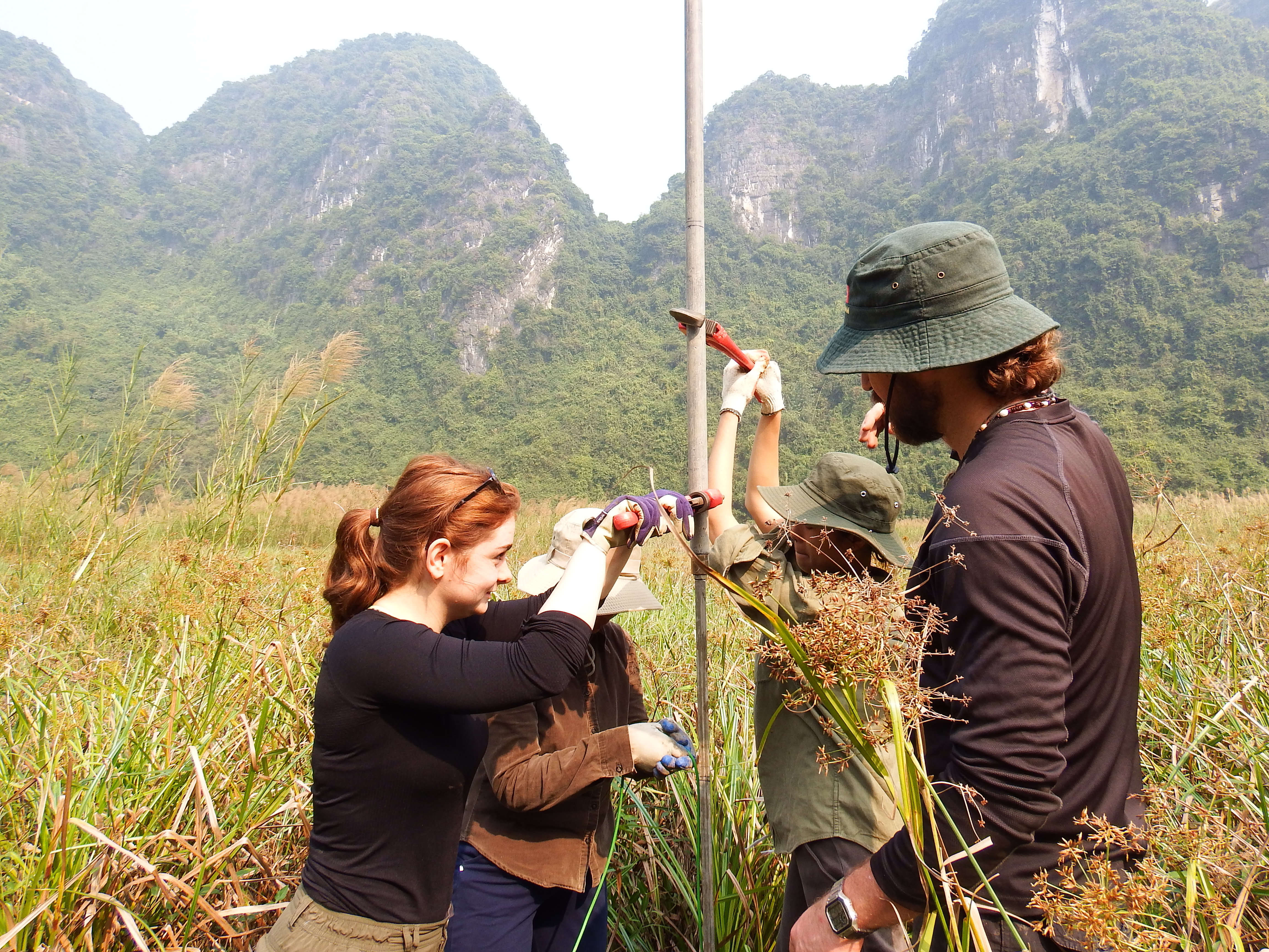
A team will carry out prospective test-pitting at three potential future sites: a prospective rock-shelter on the Eastern side of the Ui Valley, the recently identified Hang Nuoc, and Hang Trau Bai Dinh. If any other these prove to be archaeologically promising, the team will open a 1×1 m square. In addition, other elements of the landscape survey work will include: a lithic raw material survey, and sea-notch survey. The intention also is for this season to see the completion of our SUAV work within the primary transect of the massif (comprising just over 50% of the total area of the property’s core-zone). Finally, we shall collect, assess and reset our network of wildlife trail cameras.
Field Team (UK):
Ryan Rabett (QUB)
Christopher Stimpson (QUB)
Thorsten Kahlert (QUB)
Shawn O’Donnell (QUB)
Rachael Holmes (Bournemouth Univ.)
Ciaran Kelly (QUB)
Meghan McAllister (QUB)
Emilie Green (QUB)
Adrianna Zajac (QUB)
Ruairidh Macleod (University of Cambridge)
Benjamin Utting (University of Cambridge)
Field Team (Vietnam):
Miss Hao (Institute of Archaeology)
Nguyen Thi Mai Huong (Institute of Archaeology)
Vu Thi Lien (Trang An Management Board)
Vu Duy Linh (Archaeological Officer, Trang An Management Board)
Nguyen Thu Loan (Trang An Management Board)
Truong Thi Quynh Trang (Trang An Management Board)
Vu Thuy Linh (Trang An Management Board)
Selected photographs from the field season:
Sediment coring in Thung Ui (Ui Valley) (photo: R. Rabett).

Test-pit excavation under way at Hang Trau Bai Dinh (photo: S. O’Donnell).

Collecting herbarium specimens (photo: S. O’Donnell).

Season 5: 21st November – 12th December 2017
Objectives:
Six objectives were set for the November-December season. The first of these involved the continuation of excavations in Trench 2 at Hang Thung Binh 1 on the northwestern periphery of Tràng An and, primarily, investigation of a midden deposit that was uncovered here towards the end of the September 2017 season. The character of this deposit is comparable to a small midden that this project excavated in the second, smaller entrance to this cave earlier this year (Trench 1), and which has been radiocarbon dated to 17.4-17.9 Ka. Such antiquity was unexpected, given a shell-rich Holocene-aged midden had been uncovered previously towards the back of the cave’s main chamber by the Vietnamese Institute of Archaeology. Our efforts in September 2017 with colleagues from the Institute, and through this coming season, are focused in the mouth of the main chamber, and expanding the significant occupational record of this site.
The second objective for the season was to recommence parallel excavations at Hang Moi, in the centre of the property. This site has been under investigation intermittently over a period of years from by the predecessor to this project (2011) and the Vietnamese Institute of Archaeology (2012) and by SUNDASIA (2016). The site appears to have contained spatially discrete habitation and discard (midden) areas during a period of occupation 5.4-5.6 Ka during Vietnam’s the early Neolithic (Da But) and has already furnished a significant record of economic and residential practice associated with that cultural complex. Excavations by the Institute of Archaeology revealed that a sequence of earlier shell midden deposits underlay Neolithic use of the cave and extended its occupational record back to slightly beyond the Pleistocene-Holocene transition (c.11.7 Ka). Our investigations this season, in a different part of Hang Moi, seek to achieve similar deposits and expand understanding about human use of the interior landscape of Tràng An during the climatic optimum and period of enhanced monsoon during the Early Holocene.
Following a successful first season in September 2017, and guided by previous work sedimentological coring undertaken by the Vietnamese Institute of Geoscience and Mineral Resources (VIGMR), the Project’s team that is reconstructing Tràng An’s palaeoenvironmental sequence was to undertake prospective augering in what we anticipated to be optimal settings for pollen preservation in the property’s central dolines (principally, Vung Tham and Vung Chay). On the basis of results from these bore holes, and working with colleagues from VIGMR, during this season we aimed to undertake deeper mechanised coring at the most promising sites. These efforts constituted the third of this season’s main objectives.
The fourth objective involved continued digital terrain mapping of the property’s core zone that was also begun in September through drone and LiDAR survey data. The combination of data from these two methods meant that by the end of the last season 1953/6156 Ha or (31.6%) of the core zone had been scanned to sub-one metre resolution. The intention for this season was to concentrate drone survey coverage within the central area of the property in order to establish a c.2 km wide corridor connecting eastern and western margins of the massif and expand overall coverage to close to 50% of the core zone.
The fifth objective related to the use of trail cameras within the core zone to log animal movements and build a picture of modern non-arboreal vertebrates presence and diversity as a point of comparison to what we are recovering archaeologically. Trail cameras set in September were collected and analysed, ahead of re-deployment at the end of this season. A single trail camera was set at the cave site of Hang Ang Noi to help determine the identity of the species of bat and bird that are using the cave as a roost and who are by extension are responsible for the pellet and deadfall assemblage the project is periodically monitoring.
Finally, the sixth objective for the November-December season involves the collection and field study of freshwater crabs and modern plants as modern comparatives to archaeological specimens being studied by two of the undergraduates working with the project.
Field Team (UK):
Ryan Rabett (QUB)
Christopher Stimpson (QUB)
Thorsten Kahlert (QUB)
Shawn O’Donnell (QUB)
Marc Verhoeven (AAP Archaeological Consultancy, The Netherlands)
Rachael Holmes (Bournemouth Univ.)
Ciaran Kelly (QUB)
Ruairidh Macleod (University of Cambridge)
Field Team (Vietnam):
Pham Tuan Luan (Ninh Binh Provincial Museum)
Tran Thi Kim Quy (Curator, Long An Provincial Museum; Senckenberg Rearch Institute, Germany)
Le Thi Thanh Kim Hue (Trang An Management Board)
Vu Thi Lien (Trang An Management Board)
Vu Duy Linh (Archaeological Officer, Trang An Management Board)
Nguyen Thu Loan (Trang An Management Board)
Truong Thi Quynh Trang (Trang An Management Board)
Vu Thuy Linh (Trang An Management Board)
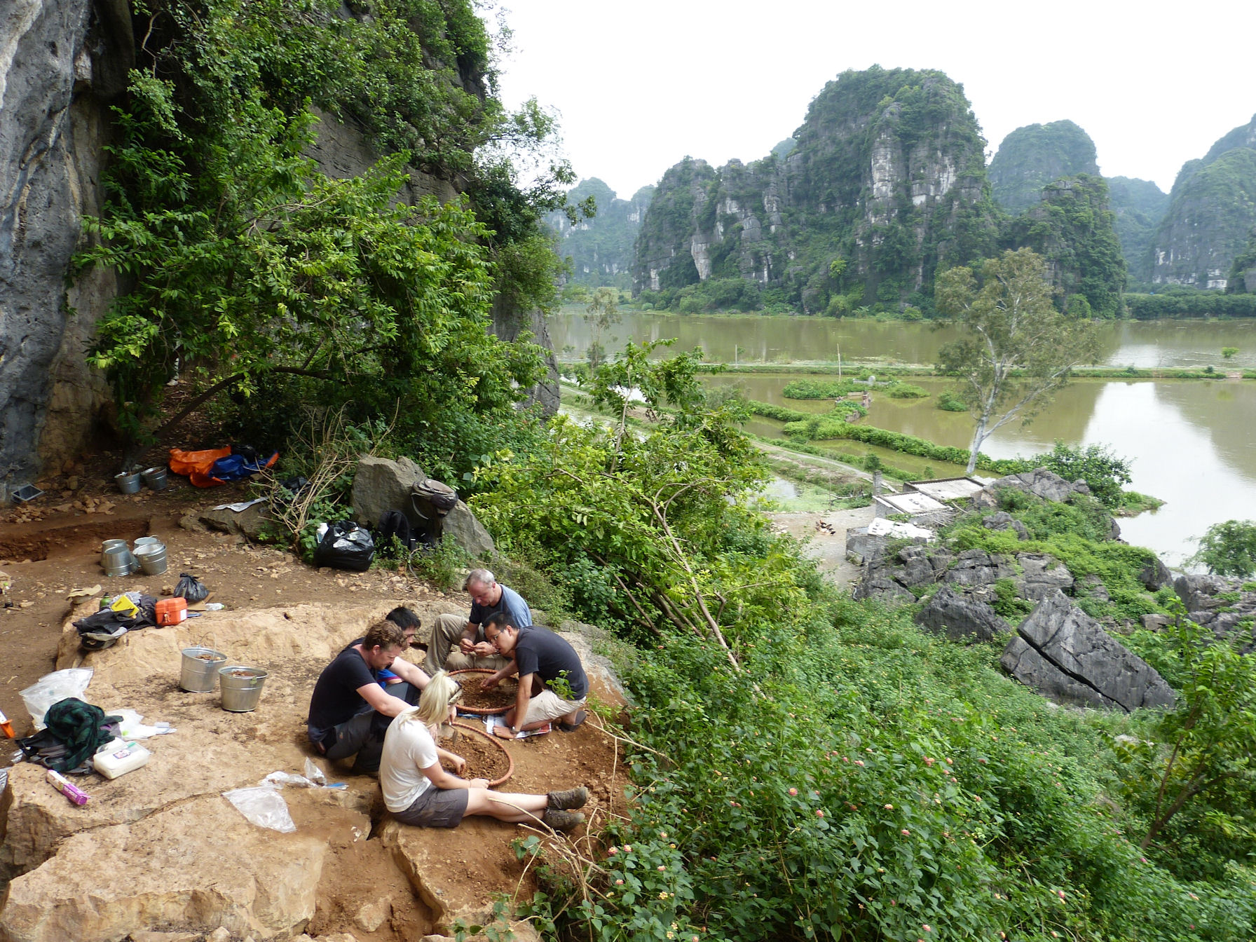
Selected photographs from the field season:
Excavations underway in Trench 2 at Thung Binh 1 (photo: R. Rabett).

Reviewing excavations in Trench 1 (back of shot) towards the end of the season in Hang Moi (photo: R. Rabett).

Mechanised coring in Vung Tham (photo: R. Rabett).

Season 4: 5th – 24th September 2017
Objectives:
The fourth field season of the SUNDASIA Project was the first to pursue research programmes across all of its principal work packages: in archaeology, GIS and digital terrain mapping, chronometric and palaeoenvironmental reconstruction; with further steps also made in both conservation and management field training. There were six objectives for this season to be met through the efforts of the largest field-team to-date (22 people – including three doctoral and five undergraduate students).
The first objective involved continuation of the landscape survey and mapping programme (sites, locales and marine features), which commenced in March/April this year; now with the aid of a SUAV (Small Unmanned Aerial Vehicle) – or ‘drone’ – to produce photogrammetric landscape imagery (at c. 220 m altitude). As part of this work, for the first time, all locations of interest, project activities, and project-related activities were logged using a standardised alpha-numeric identification system for entry and manipulation within a GIS database environment.
From an archaeological perspective our intention, and second objective, was to return to Hang Thung Binh 1 to continue excavation in Trench 1 in light of the unexpected antiquity of cultural material excavated from here in March/April of this year; and to open a new complementary trench. This work – including obtaining samples for magnetic susceptibility (for a student dissertation) – was intended to take place during the first half of the season, with excavation shifting in the latter half of the season to another site – also identified in March/April 2017 as having promising archaeological potential earlier this year: Hang Trau Bai Dinh. In the event, excavations were confined to Hang Thung Binh 1 for the whole season.
Use of the GIS unique identifier system extended to the third and fourth of our objectives. Field collection of modern cyclophorids was undertaken from a range of geographic settings around the massif, completing principal coverage of baseline shell data needed for carbon off-set analysis – and beginning the establishment of a local calibration curve for terrestrial shell dating. Sites in our palaeoenvironmental programme (i.e. where pollen traps for modern comparative pollen samples have been situated and where prospective sedimentological hand-coring has been undertaken) were also allocated identifiers under the same system.
The fifth objective centred on the Project’s ongoing commitment to aligning archaeological and conservation ambitions in data-collection. To this end, a series of infrared, motion-sensitive trail cameras were to be placed within a stretch of forest in the core zone least affected by infrastructure, disturbance and visitation. From a conservation perspective this would begin the process of assessing the current state of non-arboreal vertebrate biodiversity within Tràng An. Archaeologically, this work would provide a valuable point of comparison to the extensive zooarchaeological remains being recovered in excavation. In addition, and as part of another student dissertation, we continued field-collection of small vertebrate remains (comprising deadfall, and owl pellet contents) from the site of Hang Ang Noi. This cave is located within the core zone, at an interface between the park’s undeveloped interior and one of its arterial access routes, making it an excellent marker-site for tracking changes in species representation, and through this any disturbance in resident fauna.
Capacity building and knowledge exchange are central to the ambitions of the SUNDASIA Project. The sixth and final objective for this season has been to develop these ambitions through continued direct involvement of Tràng An Management Board staff in all aspects of fieldwork; as well as direct collaboration and mutual exchange of knowledge with key Vietnamese institutions and researchers.
Field Team (UK):
Ryan Rabett (QUB)
Fiona Coward (Bournemouth Univ.)
Christopher Stimpson (QUB)
Thorsten Kahlert (QUB)
Shawn O’Donnell (QUB)
Ioanna Bachtsevanidou Strantzali (QUB)
Benjamin Utting (Cambridge)
Rachael Holmes (Bournemouth Univ.)
Emilie Green (QUB)
Meghan McAllister (QUB)
Ciaran Kelly (QUB)
Aaron Redmond (QUB)
Field Team (Vietnam):
Nguyen Truong Dong (Institute of Archaeology)
Nguyen Thi Mai Huong (Institute of Archaeology)
Pham Tuan Luan (Ninh Binh Provincial Museum)
Vo Thi Phuong Thuy (National Dong Hwa University, Taiwan; Institute of History, Hanoi)
Le Thi Thanh Kim Hue (Trang An Management Board)
Vu Thi Lien (Trang An Management Board)
Vu Duy Linh (Archaeological Officer, Trang An Management Board)
Nguyen Thu Loan (Trang An Management Board)
Truong Thi Quynh Trang (Trang An Management Board)
Vu Thuy Linh (Trang An Management Board)
Selected photographs from the field season:
An example of the stunning images that the SUAV was able to obtain (photo: Thorsten Kahlert / SUNDASIA / Centre for Geographic Information Science and Geomatics, QUB).

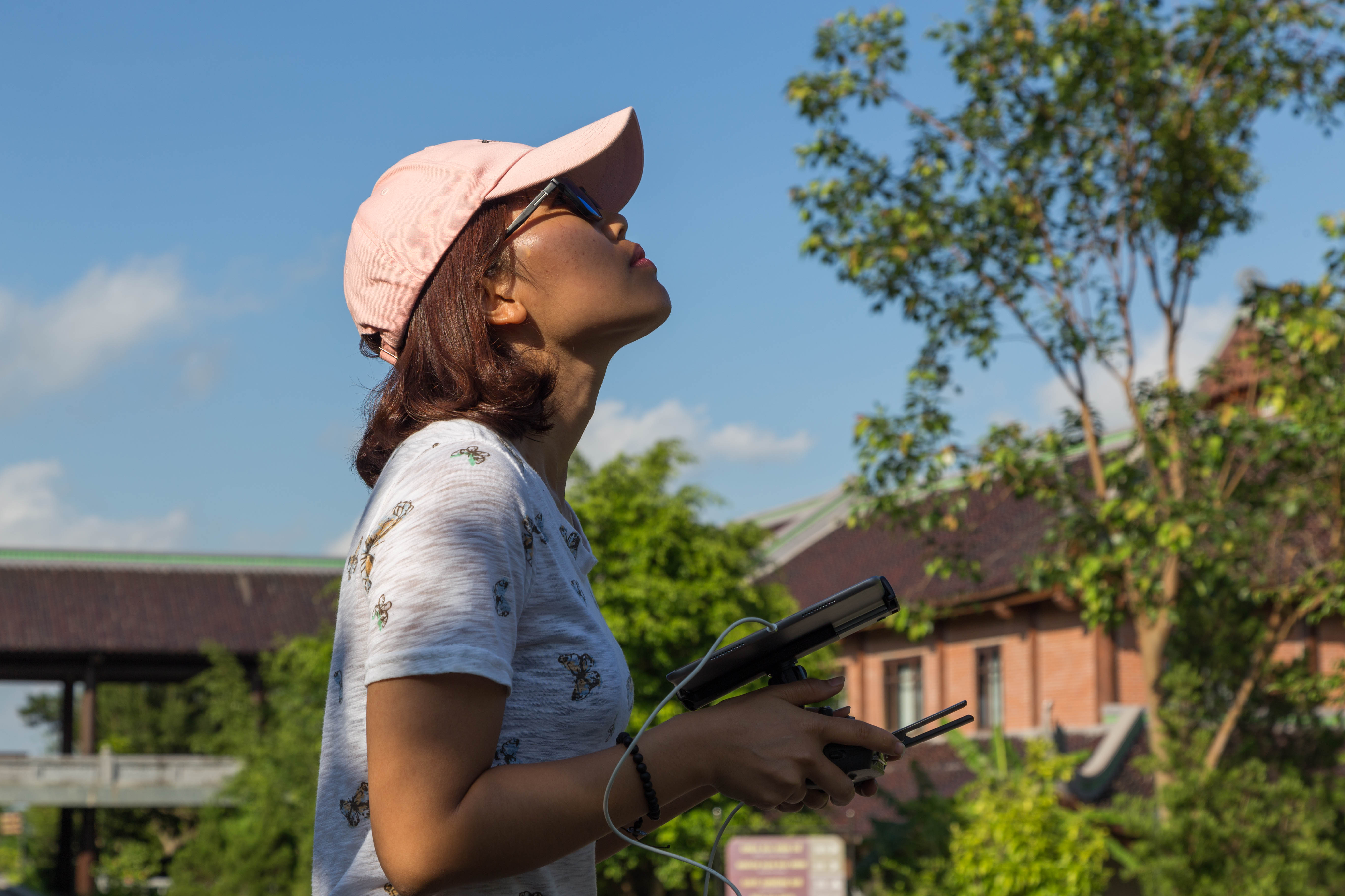
Le Thi Thanh Kim Hue piloting the SUAV (photo: Thorsten Kahlert / SUNDASIA).
Excavations under way in Trench 2, Hang Thung Binh 1 (photo: Ryan Rabett / SUNDASIA).

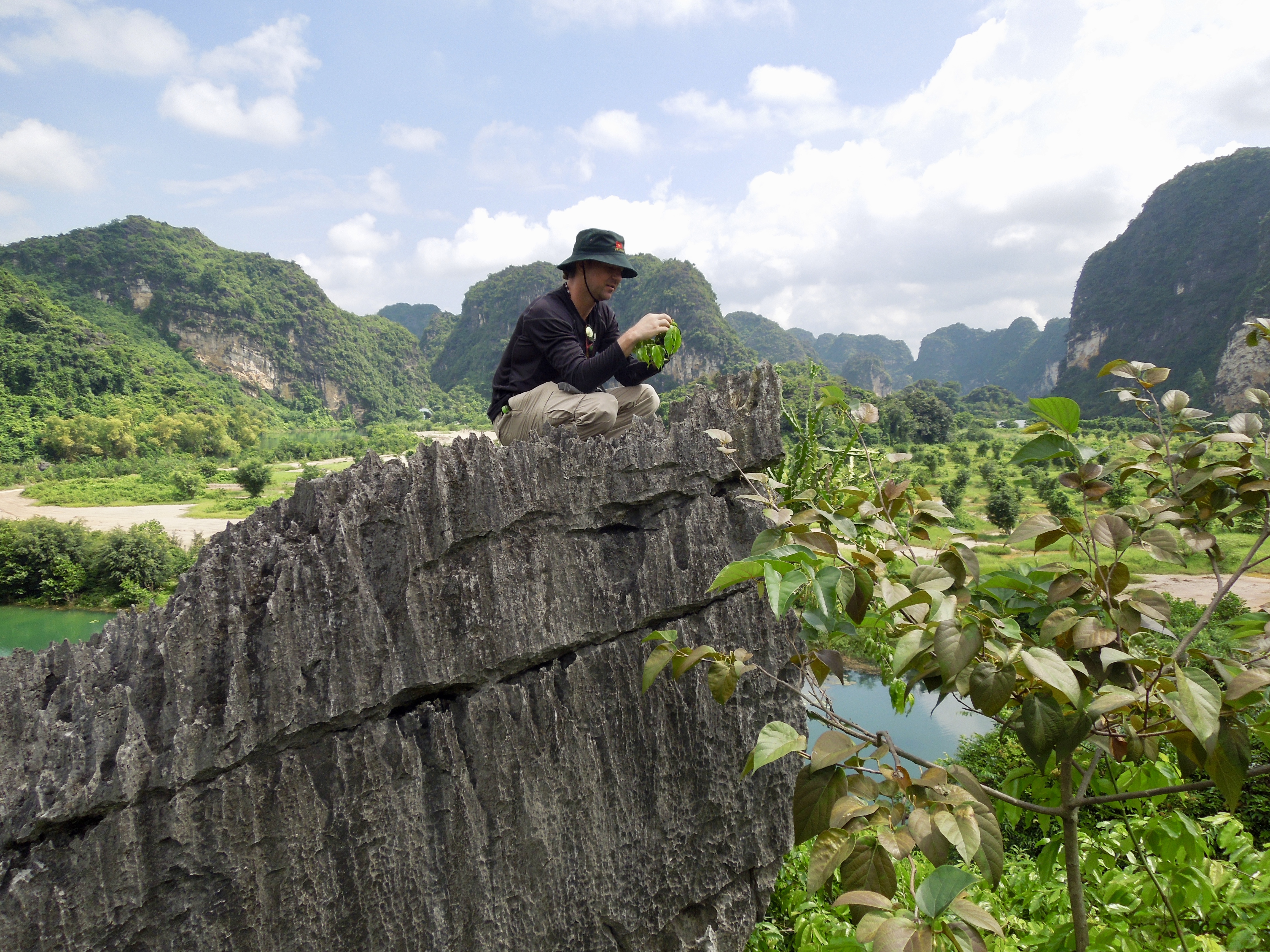
Shawn O’Donnell ‘botanising’ (photo: Thorsten Kahlert / SUNDASIA / Centre for Geographic Information Science and Geomatics, QUB).
Season 3: 20th March – 6th April 2017
Objectives:
This season of work comprised two main components. The first was a two-day project workshop (18th and 19th March) at which members presented progress reports on their individual work packages, and challenges and opportunities (such as in the area of biodiversity) were discussed with Vietnamese colleagues and invited experts.
The second component of work was a fieldwork period from 20th March – 6th April. This involved archaeological excavations at Thung Binh 1, with the aim to advance our understanding of prehistoric peoples during the early to mid-Holocene; and a topographic survey and cave assessment programme.
Field Team (UK):
Ryan Rabett (QUB)
Christopher Stimpson (QUB)
Thorsten Kahlert (QUB)
Ioanna Bachtsevanidou Strantzali (QUB)
Benjamin Utting (Cambridge)
Field Team (Vietnam):
Le Thi Thanh Kim Hue (Trang An Management Board)
Vu Thi Lien (Trang An Management Board)
Vu Duy Linh (Archaeological Officer, Trang An Management Board)
Nguyen Thu Loan (Trang An Management Board)
Tran Thi Kim Quy (Curator, Long An Provincial Museum; Senckenberg Rearch Institute, Germany)
Selected photographs from the field season:
Excavations underway at Thung Binh 1 (photo: Ryan Rabett / SUNDASIA).
Thorsten Kahlert taking one of more than 1000 sites photos of Thung Binh 1 to create a 3D digital site model (photo: Ryan Rabett / SUNDASIA).
Surveying for sites (photos: Le Thi Thanh Kim Hue & Thorsten Kahlert / SUNDASIA)


Season 2: 30th November – 21st December 2016
Objectives:
The second field season of 2016 (managed and led by Christopher Stimpson) will have three main objectives. The first of these will be re-opening excavations at Hang Moi, a site previously investigated in 2011 by the current project and in 2012 by Vietnamese colleagues. Hang Moi is located inside the Tràng An massif and contains Neolithic (Da But) and earlier cultural deposits that span the mid-Holocene high-stand and the Pleistocene-Holocene transition. Our principal aim this season is to further investigate a midden that was uncovered in 2011 (Trench 2).
Secondly, the team will continue excavations begun in August at the Hang Hanh rockshelter on the periphery of the massif, where Da But cultural material has also been uncovered.
Thirdly, Thorsten Kahlert will meet with colleagues at the Vietnam Institute for Geosciences and Mineral Resources (VIGMR) and undertake preliminary field survey (assisted by Rachael Holmes) towards creation of the project’s GIS database and terrain-mapping programme.
Field Team (UK):
Christopher Stimpson (QUB)
Thorsten Kahlert (QUB)
Rachael Holmes (BU)
Benjamin Utting (Cambridge)
Marc Verhoeven (AAP Archaeological Consultancy, The Netherlands)
Field Team (Vietnam):
Nguyen Truong Dong (Institute of Archaeology)
Season 1: 22nd August – 11th September 2016
Objectives:
This field season will have four research objectives. Firstly, we shall carry out a geophysical survey using ground-penetrating radar (GPR) at a dozen cave sites within the interior and around the periphery of the Tràng An massif. This will be undertaken by Ashely Green (Bournemouth University, BU), this is the first such study conducted in Tràng An, and will provide a valuable guide for the project’s excavation strategy.
Secondly, a survey of the modern-day biodiversity of Tràng An will be initiated. This will be led by Darren Mann (Head of Life Collections and the insect specialist at Oxford University Museum of Natural History, OUMNH), will draw upon local expertise within the Tràng An Management Board, and involve local students. Extending our understanding of the landscape’s current biodiversity will create important points of comparison to the prehistoric character of the massif, particularly with respect to tracking habitat and species change or resilience through time.
Thirdly, test excavations will commence with UK-Vietnamese teams at two groups of cave sites located close to the perimeter of the massif, led by Christopher Stimpson. Data from these will expand and complement the existing archaeological record from the interior of the massif.
Fourthly, working with the Ninh Binh People’s Committee, the Tràng An Management Board, and other colleagues, Ryan Rabett and Tran Tan Van will also lay the ground-work for forthcoming project work-packages (in the fields of: isotope analyis, GIS modelling, and palaeoenvironmental reconstruction), as well as develop the public profile of the project in Vietnam with local media.
Field Team (UK):
Ryan Rabett (QUB)
Christopher Stimpson (QUB)
Paul Owens (QUB)
David Simpson (QUB)
Ashely Green (BU)
Rachael Holmes (BU)
Lucy Farr (University of Cambridge)
Darren Mann (OUMNH)
James Bullen (independent)
Field Team (Vietnam):
Nguyen Truong Dong (Institute of Archaeology)
Pham Thanh Son (Institute of Archaeology)
Selected photographs from the field season:
Site survey and test excavations at Hang Ang Noi


Test excavation at Hang Hanh rock-shelter (photo: T. Kahlert)

GPR survey work at the Temple rock-shelter (photo: R. Rabett)

(Featured image: field-processing during excavations at Hang Trong – R. Rabett) Main text images credits: images 1,4-6 S. O’Donnell; images 2 and 3 R. Holmes; images 7-9, 12, 14-16, 19-22 and 25 R. Rabett; images 10,11, 13, 23 and 24 T. Kahlert; images 17 and 18 Le Thi Thanh Kim Hue & T. Kahlert;
